5nights plus 2 nights in hotel
-
Transfer from Airport to Hotel then to Machame Gate , Depend on Group Size
-
Mid Range Hotels and Camps
-
Arusha
-
July , August , September, December; January , Februaty
-
Kilimanjaro Climbing
-
All meals
-
English, Spanish, French, Chinese
-
2-15
-
12
-
65
Visit
TARANGIRE NATIONAL PARK & NGORONGORO CRATER
Overview
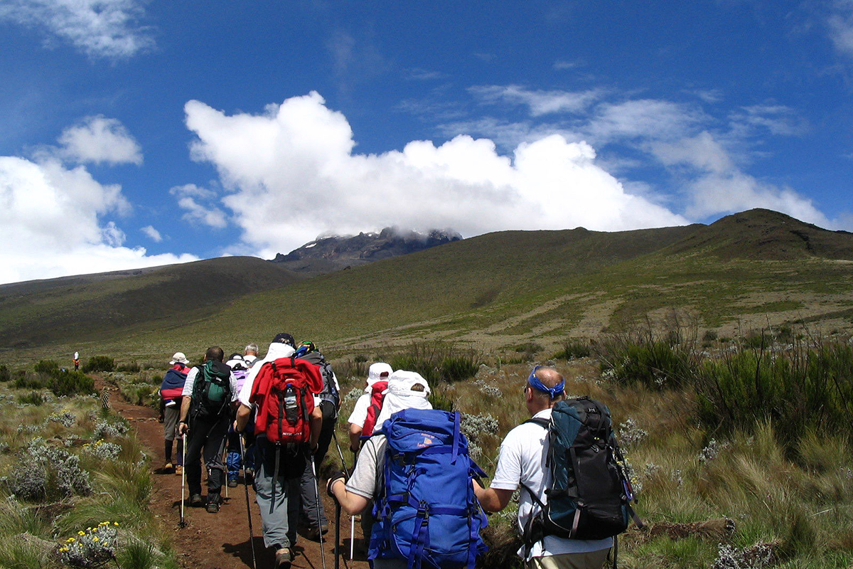
The Machame route, also known as the Whisky Route, is one of the most scenic and recommended routes on Kilimanjaro. This popular route with paths through magnificent forests to gain a ridge that leads through the moorland zones to the Shira Plateau. It then traverses beneath the glaciated precipices of the Southern Ice fields to join the Barafu Route to the summit. Because it can be done over longer periods and the incline is more manageable it has
a much higher success rate of summit.
Highlights
- Higher Summit Success Rate: The extra day at Horombo Hut for acclimatization significantly improves your chances of reaching the summit compared to the 5-day route.
- Diverse Habitats: The trek takes you through four distinct climate zones, starting in the lush Montane Forest, transitioning to the open Heathland and Alpine Desert, and culminating in the Arctic Summit zone. This rapid change in scenery provides a varied and memorable experience.
- Gradual Slope: The path is well-defined with a more gentle incline, making the initial days of the climb less strenuous.
- Scenic Diversity: The route takes you through multiple climate zones, from lush rainforest to the arctic summit.
- Climb High, Sleep Low" Acclimatization: The optional hike on Day 4 helps your body adjust to the altitude, a proven strategy for preventing altitude sickness.
Itinerary
10.75k /7mi | 5-6 hrs | Rainforest
Elevation: 1811m/5942ft to 3021m/9911ft
Altitude gained: 1210m
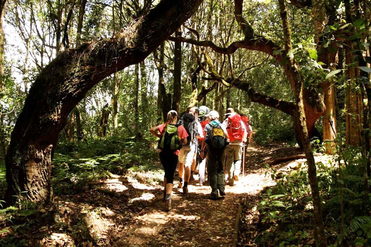
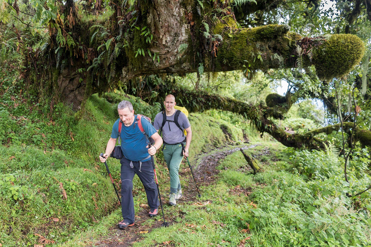
Departing from Moshi, a 45-minute drive will take you through the Village of Machame to the Kilimanjaro National Park Gate. We will patiently wait for our permits to be issued while watching the hustle and bustle of operations as many crews prepare for the journey ahead. Enjoy the beautiful rainforest scenery and windy trails while your guide tells you about the local flora and fauna and natural wildlife. At these lower elevations, the trail can be muddy and quite
slippery. We highly recommend gaiters and trekking poles here.
Elevation: 3021m/9911ft to 3839m/12,595ft
Altitude gained: 818m
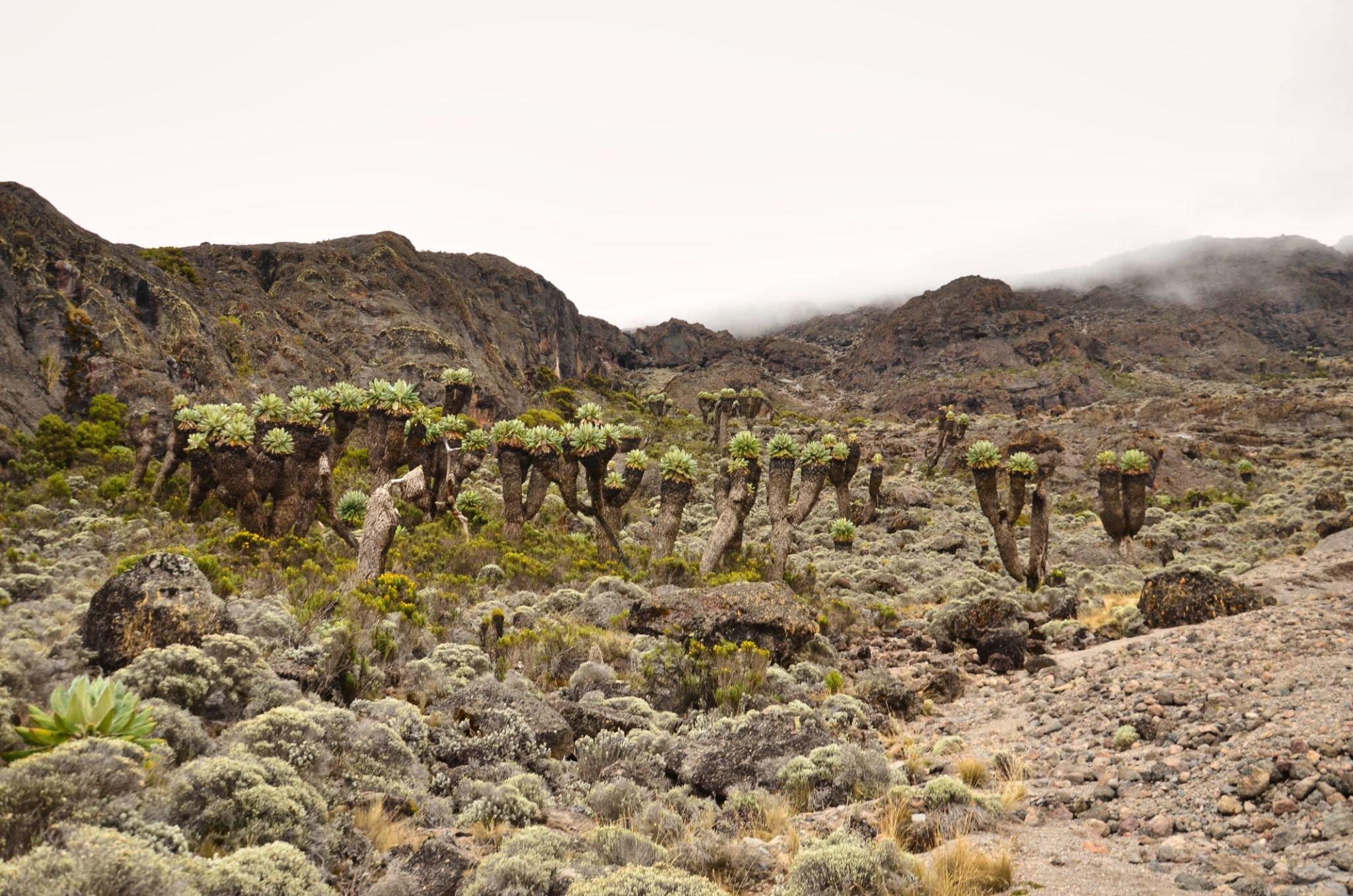
After a good nights sleep and a hearty breakfast, we emerge from the rain forest and continue on an ascending path, crossing the valley along a steep rocky ridge. The route now turns west onto a river gorge until we arrive at the Shira campsite. Temperatures begin to drop.
Semi-Desert
Elevation: 3839m/12,595ft to 3986m/13,077ft
Altitude gained: 147m
Although you end the day around the same elevation as when you began, this day is very important for acclimatization. From Shira Plateau, we continue east up a ridge, passing the
junction towards the Kibo peak, before we then continue, southeast towards the Lava Tower, called the “Shark’s Tooth” (elev. 4650m/15,250ft). Shortly after the tower, we come to a second
junction, which leads to the Arrow Glacier. We then continue to descend overnight at Barranco Camp.
Alpine Desert
Elevation: 3986m/13,077ft to 4034m/13,235ft to 4662m/15,295ft
Altitude gained: 676m
After breakfast, we continue on a steep ridge up to the adventurous Barranco Wall to the Karanga Valley and the junction, which connects with the Mweka Trail. This is one of the most impressive days to see the power, agility, and strength of your crew zip over this wall with what appears to be such ease. We continue up toward Barafu Camp, and once reached, you have now completed the South Circuit, which offers a variety of breathtaking views of the summit from many different angles. An early dinner and rest as we prepare for summit night. Overnight at Barafu Camp.
down | 5-6hrs | Glaciers, Snow Capped Summit
Elevation: 4662m/15,295ft to 5895m/19,341ft
Altitude gained: 1233m
Descent to 3106m/10,190ft
Altitude lost: 2789m
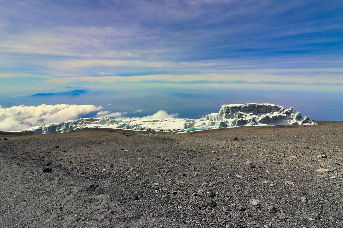
Excitement is building as morning comes with an early start between midnight and 2 a.m. This is the most mentally and physically challenging portion of the trek.
We continue our way to the summit between the Rebmann and Ratzel glaciers trying to stay warm and focused on the amazing sense of accomplishment that lies ahead. With a switchback
motion in a northwesterly direction and ascend through heavy scree towards Stella Point on the crater rim. You will be rewarded with the most magnificent sunrise during your short rest here.
Faster hikers may view the sunrise from the summit. From here on, your remaining 1 hour ascent to Uhuru Peak, you are likely to encounter snow all the way.
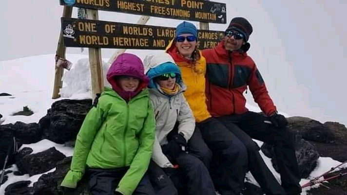
Congratulations, one step at a time, you have now reached Uhuru Peak, the highest point on Mount Kilimanjaro and the entire continent of Africa!
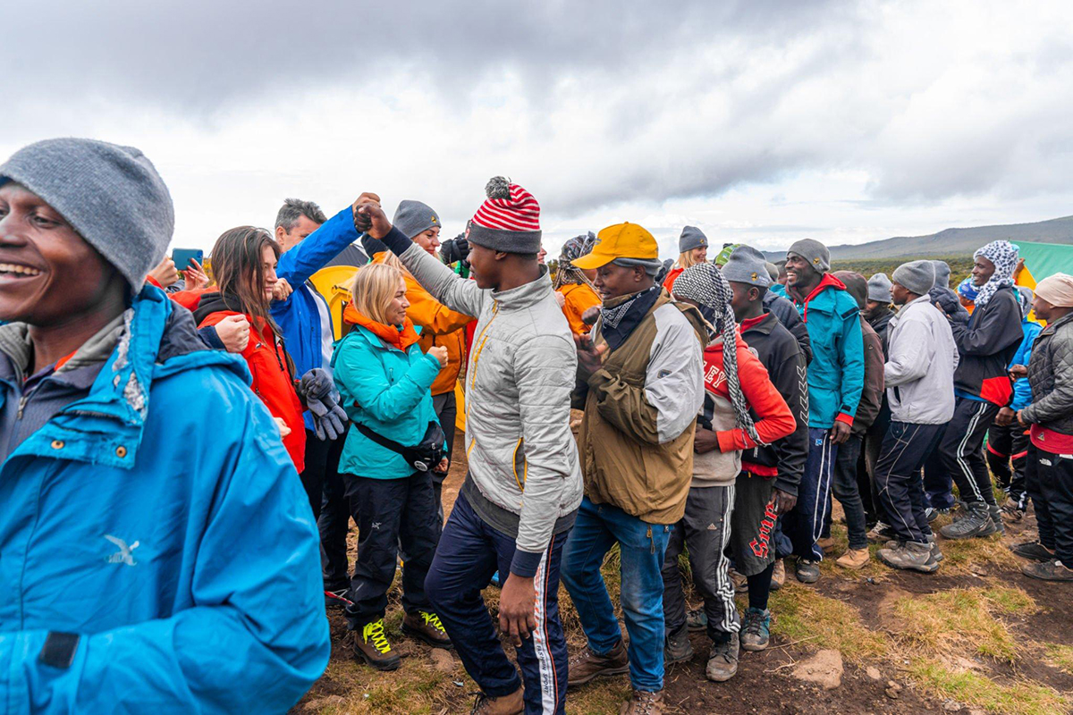
After photos, celebrations, and maybe a few tears of joy, we take a few moments to enjoy this incredible accomplishment. We begin our steep descent down to Mweka Camp, stopping at
Barafu for lunch and a very brief rest. We strongly recommend gaiters and trekking poles for uncooperative, loose gravel, and volcanic ash terrain. Well-deserved rest awaits you to enjoy your
last evening on the mountain. Overnight Mweka Camp.
Elevation: 3106m/10,190ft to 1633m/5358ft
Altitude lost: 1473m
After breakfast and a heartfelt ceremony of appreciation and team bonding with your crew, it’s time to say goodbye. We continue the descent down to the Mweka Park Gate to receive your summit certificates. As the weather is drastically warmer, the terrain is wet, muddy, and steep, and we highly recommend Gaiters and trekking poles.
From the gate, a vehicle will meet you at Mweka village to drive you back to your hotel in Moshi (about 30 minutes). Enjoy a long overdue hot shower, dinner, and celebrations!!
Overnight at Lindrin Lodge B&B
Cost
The Cost Includes
- Kilimanjaro trekking according to the itinerary
- Professional, English-speaking guide
- Mountain crew (cook & porters)
- Overnight stays in mountain huts
- Meals according to the itinerary
- Drinking water, tea & coffee
- All national park fees
- Transfer from the hotel to the National park gate and back
The Cost Excludes
- International Flights
- Optional activities
- Alcoholic and soft drinks
- Visa fees
- Tips
- Personal spending money for souvenirs etc.
- Travel insurance
- Tipping suggestion $10 a day per vehicle. The tip should be handed to the driver/guide at the end of the
- trip
FAQs
The success rate for the Machame Route is one of its most attractive features. The 7-day itinerary has an average summit success rate of 85-90%, while the shorter 6-day version has a rate of around 70-75%. The longer itinerary is highly recommended because it provides better acclimatization, significantly increasing your chances of reaching the peak.
The Machame Route is considered a moderately difficult trek. It is more challenging than the Marangu Route due to steeper sections, longer daily hikes, and a camping-based itinerary. However, it’s very manageable for individuals with good physical fitness and no prior high-altitude experience. Key challenges include:
-
Steep sections on days 2 and 3.
-
The Barranco Wall, a non-technical but steep rock face that requires a bit of scrambling.
-
The long and challenging summit day, which can take 12-15 hours.
The “climb high, sleep low” principle is a fundamental strategy for altitude acclimatization. It involves hiking to a higher elevation during the day and then descending to a lower camp to sleep. The Machame Route is an excellent example of this. On Day 3, you hike up to Lava Tower (4,630m / 15,190ft) before descending to Barranco Camp (3,900m / 12,800ft) for the night. This allows your body to start adapting to the high altitude without the added stress of sleeping there, which is a major factor in the route’s high success rate.
The Machame Route is often contrasted with the Marangu Route, and they have several key differences:
-
Accommodation: Machame is a camping route where you sleep in tents every night. Marangu is the only route with communal huts.
-
Success Rate: Machame (especially the 7-day version) has a much higher summit success rate due to its superior acclimatization profile.
-
Scenery: Machame is a more scenic route that traverses the mountain in a non-linear path, offering diverse landscapes and views. Marangu follows the same trail for both the ascent and descent, which can feel repetitive.
-
Difficulty: Machame is considered more physically demanding than Marangu due to its steeper sections and longer hiking days.
The main difference is the addition of an extra acclimatization day. In the 6-day itinerary, you spend an extra night at Horombo Hut (Day 3), allowing your body more time to adjust to the altitude. This extra day significantly improves your chances of a successful summit, often raising the success rate by 10-15% or more.